
Imperial Federation, map of the world showing the extent of the British Empire in 1886
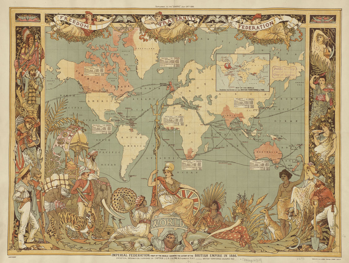
Imperial Federation, map of the world showing the extent of the British Empire in 1886
Author: Colomb, J. C. R. Publisher: MacClure & Co. Date: 1886. Location: Great Britain
By http://maps.bpl.org [CC-BY-2.0 (https://creativecommons.org/licenses/by/2.0/)], via Wikimedia Commons.
Date Published:
13 August 2012
Source:
In Collection(s):
Colonial Writers
Cite:
Imperial Federation, map of the world showing the extent of the British Empire in 1886 at https://commons.wikimedia.org/wiki/Main_Page via https://dev.writersinspire.it.ox.ac.uk/content/imperial-federation-map-world-showing-extent-british-empire-1886-0. Published on 13 August 2012. Accessed on 10 May 2026.
If reusing this resource please attribute as follows: Imperial Federation, map of the world showing the extent of the British Empire in 1886 (https://commons.wikimedia.org/wiki/Main_Page), licensed as Creative Commons BY (2.0).